DV
divyesh varade
Indian Institute of Technology Jammu
Jammu, India
1,640
Total views and downloads
Submit your idea
You will be redirected to our submission process.
Manuscript Submission Deadline 24 January 2026
This Research Topic is currently accepting articles.
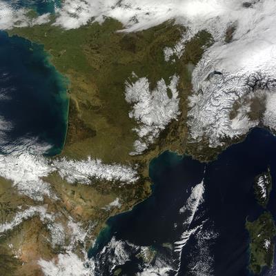
Mountain environments feature steep terrain, variable climates, and diverse ecosystems, making traditional data collection difficult. Remote sensing—using satellites, aircraft, and drones—offers a powerful alternative for monitoring these regions. Multi-sensor approaches allow for accurate observation of glacier dynamics, vegetation patterns, soil erosion, and natural hazards. Remote sensing is especially crucial in studying climate change, as glaciers and snowpacks are sensitive climate indicators. It enables ongoing tracking of ice mass balance, snow cover, and permafrost. Hydrological processes like snowmelt runoff and watershed behavior can also be analyzed for better water resource management. In ecology, remote sensing helps assess vegetation health and species distribution, supporting biodiversity and resource conservation. It also improves early detection of natural hazards, aiding disaster preparedness. When combined with geospatial analysis and machine learning, remote sensing enhances predictive modelling and strengthens resilience strategies for mountain communities facing environmental challenges.
Mountain regions pose unique challenges and opportunities for scientific exploration, environmental management, and sustainable development. For investigating these complex and dynamic landscapes, remote sensing has emerged as a powerful tool providing critical insights into the responses of such diverse and often inaccessible regions. This Research Topic aims to highlight the recent developments and the various applications of remote sensing techniques in the observation of mountainous regions covering a wider spectrum from water and environmental management to studies on the natural hazards with a specifically focusing on the complex and rugged terrain.
This Research Topic welcomes original research articles, review papers, and case studies that demonstrate the use of remote sensing technologies in mountainous regions. Topics of interest include, but are not limited to:
• Monitoring cryospheric changes: glaciers, snow cover, and permafrost.
• Assessing vegetation dynamics and ecological responses in high altitude regions.
• Analyzing sustainable resource management in mountains.
• Investigating mountain hydrology and water resource management in complex terrain.
• Detecting natural hazards and enhancing disaster risk reduction with a key emphasis to early warning in mountainous regions.
• Integrating remote sensing with machine learning and geospatial analysis for sustainable development in mountainous regions.
This Research Topic accepts the following article types, unless otherwise specified in the Research Topic description:
Articles that are accepted for publication by our external editors following rigorous peer review incur a publishing fee charged to Authors, institutions, or funders.
Keywords: remote sensing, mountain, hydro-meteorology, snow, glacier, mountain hazards, vegetation dynamics, environmental monitoring, climate change, impact, mountains
Important note: All contributions to this Research Topic must be within the scope of the section and journal to which they are submitted, as defined in their mission statements. Frontiers reserves the right to guide an out-of-scope manuscript to a more suitable section or journal at any stage of peer review.
Manuscripts can be submitted to this Research Topic via the main journal or any other participating journal.
Submit your idea
You will be redirected to our submission process.
