DF
dongjie fu
Institute of Geographic Sciences and Natural Resources Research, Chinese Academy of Sciences (CAS)
Beijing, China
1,596
Total downloads
10k
Total views and downloads
Submit your idea
You will be redirected to our submission process.
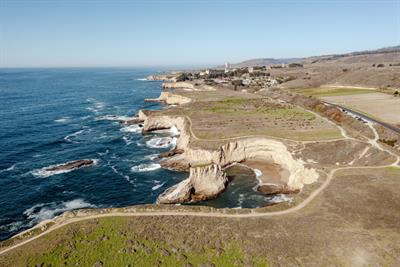
Coastal habitats, including mangroves, salt marshes, seagrass beds, and coral reefs, are critical ecosystems that provide a wide range of ecological services. including coastal protection, biodiversity conservation, and carbon sequestration. They protect coastlines, conserve biodiversity, and sequester carbon, acting as natural buffers against erosion and storms, and providing nurseries for marine life. They are playing significant roles in mitigating the effects of climate change. Despite their recognized importance, the multi-scale assessment and characterization of these coastal habitats’ diverse ecological functions remain insufficient.
With the rapid development of remote sensing technologies and big data analytics, new opportunities have emerged for environmental monitoring. Multi-scale methods utilizing satellite data, drones, and ground-based sensors provide detailed, dynamic data for coastal habitats mapping. In addition, the integration of intelligent analytics such as artificial intelligence (AI), machine learning, and deep learning further improves accuracy and resolution, enabling in-depth analysis of vast datasets across spatial and temporal scales to reveal changes in the distribution and ecological condition of coastal habitats.
The goal of this Research Topic is to explore higher-precision mapping and enhance understanding of coastal ecosystems using advanced multi-scale and big data techniques. We aim to integrate intelligent methods to process large-scale datasets for more in-depth analysis. While existing mapping products capture coastal ecosystems, they often fall short in describing ecological conditions and changes. There is a growing need for comprehensive approaches that not only map the extent of these ecosystems but also assess their ecological contributions across spatial and temporal scales to support effective conservation and management.
The focus of this Research Topic is on studies that leverage advanced remote sensing technologies and big data analytics, especially those employing AI-driven methodologies, to explore the spatial-temporal dynamics and ecological functions of coastal habitats. It calls for original and novel papers related to intelligent mapping and ecosystem monitoring in any of the following topics:
• AI-driven habitat classification
• Temporal analysis of coastal habitat changes
• High-precision mapping and inversion of habitat biophysical parameters
• Characterization of ecosystem processes
• Innovative applications in the sustainable management of coastal ecosystems
This Research Topic accepts the following article types, unless otherwise specified in the Research Topic description:
Articles that are accepted for publication by our external editors following rigorous peer review incur a publishing fee charged to Authors, institutions, or funders.
Keywords: Coastal mapping, AI-driven classification, Multi-scale remote sensing, Ecosystem monitoring, Big data analytics
Important note: All contributions to this Research Topic must be within the scope of the section and journal to which they are submitted, as defined in their mission statements. Frontiers reserves the right to guide an out-of-scope manuscript to a more suitable section or journal at any stage of peer review.
Institute of Geographic Sciences and Natural Resources Research, Chinese Academy of Sciences (CAS)
Beijing, China
Institute of Geographic Sciences and Natural Resources Research, Chinese Academy of Sciences (CAS)
Beijing, China
University of Tasmania
Hobart, Australia
Manuscripts can be submitted to this Research Topic via the main journal or any other participating journal.
Submit your idea
You will be redirected to our submission process.
