BM
bhogendra mishra
Consiglio Nazionale delle Ricerche, Area della Ricerca Milano 1
Milan, Italy
42
Total downloads
3,043
Total views and downloads
Submit your idea
Select the journal/section where you want your idea to be submitted:
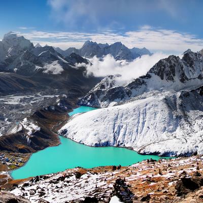
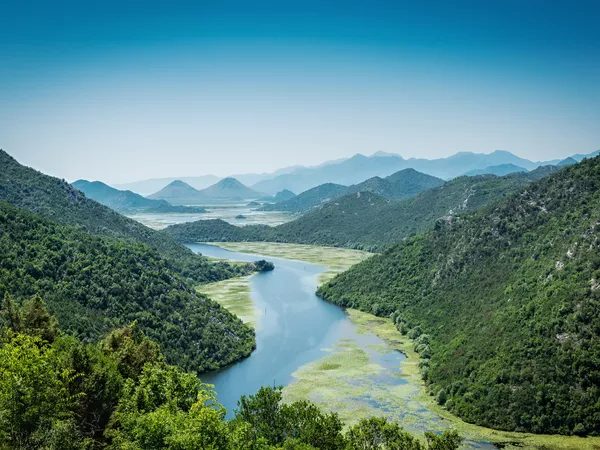
The frequency of climatic extremes and long-term shifts in weather patterns, known as Climate Change, are expected to increase in the future. These changes have multidimensional impacts on ecology, hydrology, agriculture, and ultimately on human life and sustainability. Historical evidence shows that most of the mountainous ecosystems, such as forests, agriculture, rangeland, wetland, glaciers and water bodies, are more vulnerable to such changes. Therefore, quantifying and mapping the extent of vulnerability of different ecosystems, along with assessing the impacts, is urgent to support planning and implementation of adaptation strategies to mitigate the adverse effects of extreme events and climate change. Challenging topographies which limit field-based observations and regular monitoring, have led to difficulties in gathering reliable, continuous data in mountainous environments. The advancement of Earth Observation (EO) data enables us to monitor the mountainous region at unprecedented spatio-temporal scales (e.g., meters, hours). Long term datasets of earth observations are now available for multi-decadal analysis of the Earth system. Furthermore, advanced data processing techniques and the growth of data science allows us to extract precise land surface information. Given the importance of this topic and the possibility of having interdisciplinary research, we welcome scientists to submit Original Research and Review articles that exploit Earth Observation satellite-based products and the methods used to track, the dynamics of land surfaces, climate parameters, and extreme climatic conditions across different ecosystems.
The primary goal of this Research Topic is to publish research which utilizes remote sensing technology for the betterment of understanding the dynamics and processes of ecologically sensitive and climatically vulnerable mountainous regions. The specific goals can be summarized as:
• Advancing the existing knowledge of climate change impacts on glaciers, snow cover, weather patterns, and their downstream effects;
• Showing the most advanced use of remote sensing imageries combined with big data and artificial intelligence to keep track of the Earth’s dynamics;
• Prediction of future scenarios, projecting the impacts of climate change on mountainous regions by relying on EO historical datasets involving image processing, data analytics, artificial intelligence, statistical and process based modeling;
• Encourage the interdisciplinary collaboration among environmental scientists, climatologists, geographers, data scientists and policy makers and promote global collaboration to share data and knowledge for climate change adaptation.
This Research Topic aims to publish results on theory, science, applications, and technology that contribute to mapping the impacts of climate change in mountain regions. It focuses on using the most up-to-date data, tools, and methodologies in Earth observation and remote sensing. We welcome submissions related, but not limited to, the following subtopics:
• Land cover mapping including vegetation species mapping and identification;
• Land surface energy and water balance;
• Disturbance (fire, insect, desertification);
• Agriculture (crop mapping, yield prediction, phenology, management practices);
• Forest and rangeland productivity and inventories;
• Ecological applications & Ecosystem services (wetland, biodiversity, habitat, animal population, etc.);
• Mountain settlements (mapping, energy consumption, population, etc.);
• Mountain ecosystem productivity and carbon cycles;
• Hydrology, water resources, mountain lakes;
• Cryosphere, mapping and modelling;
• Atmospheric science and meteorology; and
• Snow, ice and glaciers.
This Research Topic accepts the following article types, unless otherwise specified in the Research Topic description:
Articles that are accepted for publication by our external editors following rigorous peer review incur a publishing fee charged to Authors, institutions, or funders.
Keywords: Mountain, Remote Sensing, Data Science, Observation, Data Gap, adaptation, geography, mitigation, modelling, sustainability and development, impacts and vulnerability
Important note: All contributions to this Research Topic must be within the scope of the section and journal to which they are submitted, as defined in their mission statements. Frontiers reserves the right to guide an out-of-scope manuscript to a more suitable section or journal at any stage of peer review.
Manuscripts can be submitted to this Research Topic via the main journal or any other participating journal.
Submit your idea
Select the journal/section where you want your idea to be submitted: